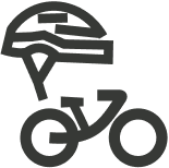
Santa Cruz Bikeway
Calm, Connected, Close to home
The Santa Cruz Bikeway is an 11-mile, segmented bike route designed to minimize exposure to car traffic. A pilot created by your own neighbors, this safer, calmer bike route uses quieter streets, scenic car-free trails, and local shortcuts to connect neighborhoods.
Pilot Impact
This pilot route ran from August 8th- October 8th, 2025 and helped riders of all experience levels feel more confident navigating Santa Cruz by bike. Now, we’re sharing what worked to help other communities do the same. See what we learned, how it worked, and how you can bring a Bikeway to your community.
86%
of respondents reported they felt “safe” using the route
95%
of respondents said they would like to see more designated low-stress routes like this in the Santa Cruz area
56%
stated that the route encouraged them to ride more often

77%
said they would recommend the route to a friend who is new to biking
4/5 comfort level
This indicates Santa Cruz bikeway was accessible for experience riders, newcomers, and community at large
Source: Based on 43 respondents


Santa cruz Bikeway: A Collaborative vision for a low-stress option
explore the route
Santa Cruz Bikeway
While the route can be ridden both directions, it is optimized to be ridden counterclockwise and provides a core route that riders can use to connect other parts of their trips.*
Preview the route
Explore the route by segment with our Point-Of-View cam and catch easy-to-miss turns with these route video guides. Click the segment on the map below or cycle through the video gallery.

West Side
Starting on the West end of the High Street Pedestrian Walkway to the Bay St. & California St. intersection.
Boardwalk
Starting at the new Bay Street bike path at the corner of California St. and rolling over the trestle bride to East Cliff Drive.
Seabright
Starting at the Crossing at East Cliff Dr. to Hiawatha Ave, crossing over and up to Soquel Dr. and Park Way.
Morrissey
Starting at the Soquel Dr. & Park Way intersection, up and over to the Goss Ave. and N. Branciforte Ave. intersection.
North/Downtown
Starting at the Goss Ave. and N. Branciforte Ave. intersection, rolling over the San Lorenzo to the High Street Pedestrian Walkway.
rider feedback
“It is a really well thought out route making it actually fun to ride without having to deal with much traffic at all! Way safer than direct routes that inexperienced cyclists find dangerous with the many fast cars, stop lights, etc.
I highly encourage the SC Bikeway to be incorporated into the city's permanent plan!”


Interested in exploring a bikeway pilot in your community?
Let’s Chat!

rider feedback
“It is a really well thought out route making it actually fun to ride without having to deal with much traffic at all! Way safer than direct routes that inexperienced cyclists find dangerous with the many fast cars, stop lights, etc.
I highly encourage the SC Bikeway to be incorporated into the city's permanent plan!”
County-wide safe bike routes
Find other low stress routes in Santa Cruz, Aptos and Watsonville.
Learn More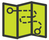
Complete Streets
Learn more about local efforts to make our streets safer and more accessible.
Learn More
Share your thoughts
Did you ride the route? Tell us what you thought and help shape the Santa Cruz Bikeway.
Do you live along the route?
We want to hear from route neighbors too! Share your feedback here.


*Disclaimers
- Participation in the Santa Cruz Bikeway involves inherent risks, including but not limited to, physical exertion, traffic conditions, weather, and road hazards. All participants assume full responsibility for their own safety and well-being during the pilot.
- All participants must comply with local traffic laws. Ecology Action is not responsible for any legal violations committed by participants.
- Cancellation or changes to the pilot schedule or route may occur due to unforeseen circumstances and notifications of any such changes will be provided as soon as possible on this website.